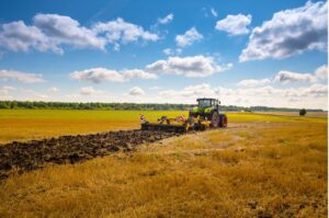
MyEasyFarm, on behalf of AIBS and CGB, has created a digital tool to collect photos of all your 2020 beet fields, whether they show signs of yellowing or drought or are healthy.
These photos will be used both to keep material evidence of the hazards but also to geo-locate all the beet plots. These photos taken in the field will enable the recovery of satellite images of the entire plot thanks to geolocation.
The aim of this tool is manifold: to keep images, tangible evidence of the presence of yellowing on the plots, which could be used in the short term to compile the individual compensation file, but also in the longer term, to build up a collective database that could be used to set up a possible project for analysing the presence of yellowing in beet crops by artificial intelligence with specialised technical and scientific partners. We invite you to take your photos as soon as possible.
This is very important for the conduct of the case at the national level. We thank you for your active collaboration in your interest and that of the beet sector.
Technical advice for use :
This tool, designed to be simple and fast, is accessible via the following web link:myeasyfarm
After creating your personal account, you will be able to identify each of your fields and upload your photos. If internet connectivity allows, you should go to your fields and take photos, which will be automatically geotagged. If not, take the photos on your plots and then upload them to the app once you return home. If your plots have already been harvested, you can either upload a previously taken photo or photograph your harvested plot, which will at least allow it to be geolocated.
Once logged in, you will receive practical tips on how to take good photos.
It is important to fill out all the fields provided in order to validate each registered plot.
Once all your plots have been registered, you can log out.
Please contact the AIBS for more information