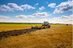
Satellite monitoring of crops, everywhere and continuously, to speed up the agro-ecological transition.
Kermap's challenge is to provide the agricultural sector with strategic, objective and reliable information, in near
real time, to support its transition. Thanks to its
Nimbo solution, the Rennes-based start-up monitors every plot of land, month after month, in 20
European countries, and soon worldwide. Soil cover, rotations, forage production
... Kermap produces this unprecedented data in 20 European countries, and soon in
the whole world. A precious resource to help the agricultural world meet the challenges
of ecological transition and climate resilience: soil preservation, water resources and biodiversity preservation
, carbon storage and optimization of
supply chains.
Knowledge of how plots of land evolve over the course of the season and over time is
a wish expressed by many private and public players. Obtaining this information
quickly and reliably is essential to encourage and support the adoption of environmentally-friendly practices. By automating and amplifying the production of indicators derived from satellite images, Kermap's Nimbo solution now makes it possible tomeet this demand.
Crop mapping 2020 freely available on agri.nimbo.earth
Satellite and AI for continuous crop monitoring.
Thanks to its massive analysis of satellite images using artificial intelligence (deep learning), Kermap delivers homogeneous, cloud-free images of the Earth every month, accessible free of charge on the Nimbo Maps platform. These visualizations, derived from Sentinel imagery (part of the European Copernicus program), are then processed by deep learning , enabling us to continuously monitor the evolution of each plot of land in 20 European countries to date. Nimbo continuously produces agricultural reference data over vast territories, while maintaining a detailed level of analysis at plot level:
● Identification of dominant crops: over 30 categories, with a one-year lead over
the Graphic Parcel Register (RPG) and a reliability rate exceeding 90%
● Near-real-time monitoring of production areas 1 to 3 months before harvest (in-
-season)
● Classification and monitoring of cover crops
● Characterization of plots over time: duration and coverage rate, plant vigor
, heterogeneity, and soon soil moisture and yield
● Crop rotation history and crop rotation projections
● Forage production index
Agricultural stakeholders can now access this information easily, quickly, and seamlessly, thanks to the Nimbo API queried by their business tools or through a custom-built monitoring platform. This information feed allows them to access:
● Crop analytics data, from 2017 to the current year
● Alert systems for crop developments
● Monthly updated base maps, integrable with geomatics processing tools
(QGis, ArcGIS…)
An operational solution, soon to have global coverage. Many stakeholders already rely on Kermap to provide them with crop monitoring data for various purposes:
● Ministry of Agriculture and Food Sovereignty (forage production and climate-related risks
)
● Nestlé and McCain (regenerative agriculture), in partnership with the Earthworm
Foundation
● Eau de Paris (water resource conservation)
● Kynetec (estimation of large-scale production areas)
● MyEasyCarbon by MyEasyFarm Low-Carbon Label for field crops)
Themodel developed by Kermap also benefits from government support throughfunding obtained under the space component ofthe France Relance plan and BPI France’s i-Nov innovationprogram . Also a winner of the first French TechDeepNum20 cohort, the Rennes-based company raised €1.2 million in its first funding round in 2022. This funding enables Kermap to accelerate the rollout of its Nimbo solutionto cover the entire globe starting in April 2023, and to expand the internationalmarketing of its satellite analysis products.
Further information: www.kermap.com
Press contact: yann.daoulas@kermap.com / +33 (0)6 03 67 42 11